

I found a clear view, inside and out, on the summit of Mount Raymond.
It is not the eye that understands, but the mind. ~ African proverb
A rocky knife-edge rose up ahead of me like the spine of a large monster. Okay, I’m being a little dramatic because I really don’t like heights. I stood there alone, wondering if this really was the trail to Mount Raymond. “Seriously, what the….?” I muttered under my breath. Then I did something completely out of place for a hiker standing out on the wilderness, I checked to see if I had a signal on my phone and Googled the trail to make sure I hadn’t left the safe and reasonable trail somewhere behind me. An article on the trail slowly loaded on my phone, “The most daunting part of the hike is a steep knife edge,” Oh my, I guess this is my trail. Yippee. I stowed the phone safely in my pack and began scrambling up the monster’s stony back…
I hadn’t been hiking solo much lately and felt a need to connect with myself on the trail. Often it takes an hour or more of rhythmic steps on a quiet hike for me to sort out what it is that I need to think through. I selected Mount Raymond because it would take four to five hours and promised a 360 view from its summit. Perhaps in that time I could find some clarity.
The trail began in Big Cottonwood Canyon at the Butler Fork Trailhead on the left side of the road. Even on a weekend I was surprised to find ample parking. The route has a few turns, which require hikers to pay attention. I would have had trouble if I hadn’t carried my topo map because the way is not very obvious at times. There is very little chance of getting lost per se, but you may have trouble getting where you hope to go.
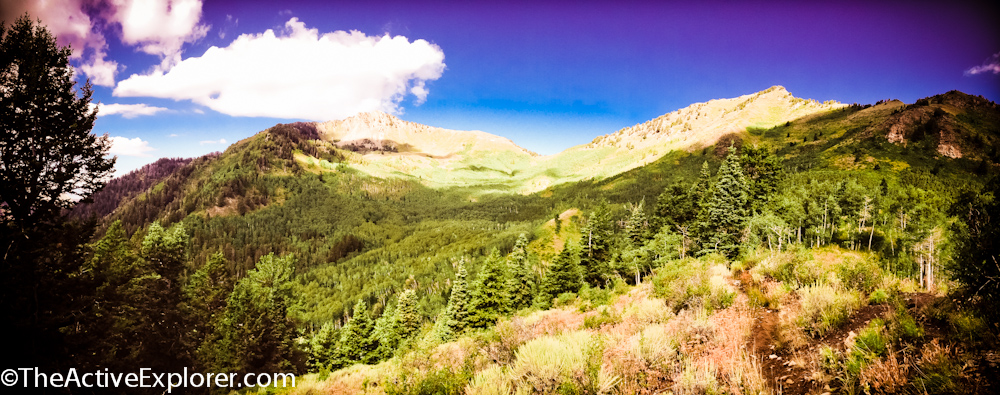
Not far from the road the trail begins rising up the mountain. At a half mile in sign said Mill A Basin to the and Dog Lake to the right. Here you keep to the left. Initially is not too scenic, but after roughly a mile, and 1,000 feet of vertical gain, it turns to the left and reveals a sweeping view of the Big Cottonwood Canyon. From this point, lovely views are plentiful. After the initial climb, the trail levels out for the most part. I would have reveled in this, but I knew the summit was 3,061 feet higher than the trailhead, so the level section meant a steeper challenge later. I’ve learned that much about hiking in the Wasatch Range, you will climb.
View of Big Cottonwood Canyon on the way to Mount Raymond
Looking up through a canopy of aspen leaves, a familiar feeling hit me, gratitude. No matter what stressors I face day-to-day in my life, I have this amazing place where I can leave it all behind. Walking further through a small meadow, I began to ponder a saying I had saved in my phone. I’m a total sap for such words, perhaps because I’m a writer. Regardless, it went like this:
Your life is now. Seize it and make it amazing. Find your voice. Discover your passion and pursue it. Be honest, generous and kind. Surround yourself with love, laughter, and truth. Let your heart be your guide. Make a difference. Be brave and wild at heart. Take chances, ask questions, be fearless. THIS is your time.

The cicadas (I think) were load and raucous. Obviously, they had no trouble finding their voice. Sometimes I have trouble finding mine. I’m afraid to voice my needs, especially when faced with someone else’s. I’ll simply focus on them while neglecting myself. Not really healthy for anyone in the end. Hmmm… There is something to ponder during my hike. What is it I’m not asking of those closest to me?
Past the meadow, the trail intersected with the Desolation Trail. After checking my map I continued on the trail leading left.
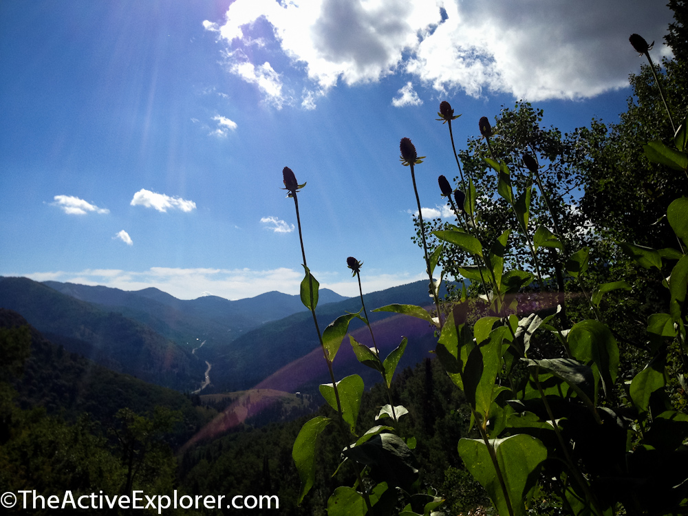
View of Mount Raymond from the meadow
At another junction there was no sign. Mount Raymond stood directly ahead and one route departed in that direction. Although not the obvious choice, the path leading to the right led to the summit. Again I was glad I’d carried a map.

This fork in the trail wasn’t intuitive. The way was to the right.
The route reached Baker’s Pass, the saddle between Gobblers Knob and Mount Raymond, and intersected with the trail leading from one to the other. Here it was an obvious choice to turn left toward Mount Raymond. Continuing straight would take you into Mill Creek Canyon. The views from here were lovely. This is where I suggest a break and energy packed snack, because there is a steep climb ahead.

Baker Pass looking toward Mount Raymond
I’d encountered very few other hikers along the way. Surprising for a Sunday. Up I climbed as the trail followed the ridgeline toward the summit. Just when I thought the vistas couldn’t be prettier, they were. Fine grass and wildflowers poked between the rocks in an artful arrangement as if a landscaper had planned the whole scene.
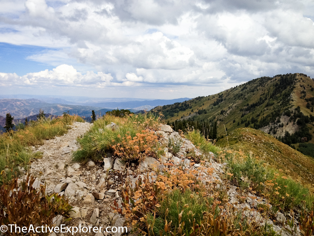
This section of the trail looked like it had been landscaped.
But then I rounded a bend and faced the knife-edge.
After my initial apprehension, I scrambled up the rocks only to find them far less intimidating once I was several feet up. The footing was solid and the drop-off not a severe as it seemed from below.

Really??? THIS is the trail?
Once across the rocky spine, the trail mostly remained a scramble to the summit. Passing over rocks and boulders, it was faint but detectable. After a final twist around to the right, I found myself standing at the summit. Slowing turning in a full circle, I took in the view from every direction. I had the 10,241-foot perch all to myself. I shot a few photos that failed to capture the totality of the 360-degree view.
After finishing lunch, I lapsed into thought about something. I’d made recent decisions that, like the trail earlier, led me in a direction that seemed counter-intuitive. I had a couple of unpleasant conversations ahead of me. Doubts crept in and I was lost in thought.
Catching myself, I returned to the view. Where had my feelings of gratitude gone just then? So many people scramble after one thing and then the next, not appreciating what they already have. Here I was, beginning to do the same thing, until the view stopped me short, reminding me to be present and grateful. “Be patient, enjoy today,” said a faint voice from my heart. Using a timer, I snapped I final photo that captured my appreciation for the view and my ability to climb to the summit.

Now I see…
“Your life is now…Find your voice…Take chances, ask questions, be fearless.” I found the clear view I needed. The hike had done its job.
If you go:
Trailhead: This route begins at the Butler Fork Trailhead – Roughly 8.2 miles up Big Cottonwood Canyon on the left.
Gear: Pack your 10 Essentials, including a windbreaker because the last mile is high elevation and exposed.
Difficulty: This is not an easy hike. It gains 3,061 feet in 4 miles. Most of the climb is realized within the first and last miles of the hike. Quite simply, it’s a butt burner. The elevation will be a challenge to those not acclimated to the thin air at altitude.
If you enjoyed this post then subscribe by email to have new posts delivered directly to your inbox. Your information will not be shared. Want even more photos and travel fun? Then follow me on Facebook , Instagram and Twitter where you will see my chatty and sometimes offbeat side.
Comments 4
Sounds like this hike would get your heart pumpin’! So, wait a minute…you’re afraid of heights??? You’re a pilot, how can that be? 🙂
Oh it doesn’t bother me in a plane! Or while rock climbing with a belay. So weird I know!
Couldn’t agree more with the words of wisdom above the 3rd pic in your post. It just so happens I remember those insights most vividly when I’m outside, exploring, as well. 🙂
– Laur
I think the outdoors is an catalyst for insight. Nice to know I’m not the only one!
Thanks Lauren!