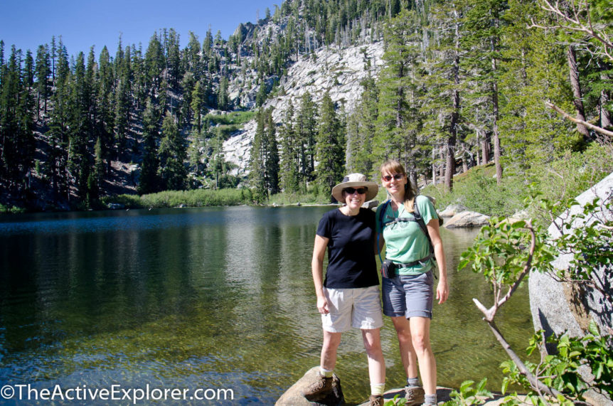

Laura and I at Granite Lake
A little background before I launch into this post. I was raised an only child by a pair of VERY adventurous parents. I knew since I was 11 years old that I had a half-sister (that the last time I’ll use the “half” part) somewhere but I had never met her. About a year ago, Laura found us and it was a mind-blowing experience, which I’ll write about later. It turns out she and I are both adventurers. She has even written a post for this blog, which you can read HERE.
Wanting to bond and get to know each other better, we spent most of July in Lake Tahoe photographing weddings, drinking, talking about boys, and hiking our butts off. That’s what sisters do right? We also pick on each other, which is where I’ll start this post.
Knowing I’m in decent shape, Laura decided to put me to the test on my first day in Tahoe. I need to point out that I live at sea level and the trail Laura chose began at 6880 feet. I was breathing like a two-pack-a-day-smoker before even getting started.
Beginning at the Bay View campground near Emerald Bay, we hiked up-hill for what seemed to be a lung collapsing long stretch, stopping briefly at Granite Lake, to an epic over-look at just over 8000 feet. In reality, it was only a couple of miles, but I was seriously feeling the altitude. After enjoying the view, we continued on a short way before veering off the mapped trail to follow a route leading to Azure Lake. The trail was pretty worn and well traveled so I’m surprised it wasn’t mapped. Fortunately, the trail was downhill so I could breathe again.

Overlooking Emerald Bay

Laura and our friend Becky checking out the view. Just Laura and I continued to Azure.
The lake was a classic example of a high Sierra lake. Granite plunged into the icy blue water and little waterfalls of snowmelt gurgled loudly. It was a spectacular venue for lunch. I had an, “I can’t believe I’m here…with my sister” moment which almost had me weepy.

Looking for a lunch spot at Azure Lake

Boulder in Azure Lake
Our route back to the trailhead had me wondering if Sis didn’t actually want Mom to herself. I think she was trying to kill me. There was no trail, just granite and brush following Cascade Creek down through the canyon. Protecting my Nikon with a death-grip, I followed. Down-climbing the huge granite boulders left me with several bruises and scrapes, and that’s when we weren’t bushwhacking.

Yup, I think she was trying to kill me.
After a while, a faint path became noticeable. I suspect local climbers use it as I found a nice looking ‘biner laying on a rock. I almost tossed it in my pack but figured only its rightful owner would know its history (and if it was safe to use).
Eventually we reached Cascade Creek Falls, full of tourists, but still pretty. Now we were back on the beaten path back to our car. The truth is I loved the trail and route we took; I just have to give my big sister grief for testing me on my first day of Tahoe hiking at altitude.
When Laura visited me in Florida, I introduced her to one of my favorite trails where she learned to watch out for cypress knees the hard way, muddy shins and all. I guess paybacks are a bitch.

Sis with muddy legs after tripping over a cypress knee while hiking a 10-mile loop with me in Florida.
If you go: This route is shown on the South Lake Tahoe Basin Recreation Topo Map by Don Douglass. It’s available in the local outfitter stores. Our route has us in both the Eldorado National Forest and the Desolation Wilderness. Permits are required while hiking in this area. Usually a day permit can be picked up at the trailheads. Overnight trips require coordinating with the ranger station. We saw rangers on the trail and had to show our permit.
Comments 7
Love the views but I think I would have been a little worried too with my bad ankles! I’ve hiked through Eldorado and Desolation but I haven’t done this hike. I love this area so I will have to do this one some day.
After my hike at Round Top which started at 8200 feet and went to over 10,000 feet, this one doesn’t look that bad. Try that one if you want to huff and puff and feel your heart explode out of your chest 🙂
Luckily I got my wind pretty quickly for our backpacking trip into Desolation and up through Dicks Pass. Never hit 10K though! Ugh!
You two have a strange way of showing sisterly love. Looks like a beautiful hike. Was there any swimming involved in those gorgeous blue waters?
Not on this hike, but there sure was on our backpacking trip. The lakes were cold! Very refreshing after a long day of hiking though.
Hey, sis; Just got back from 4 days in Desolation. I found some lakes you would love! And, yes, getting to some of them involved some cross country. You would have hated me at first but forgiven me immediately when you arrived at the destination. Sisterly love is a wonderful thing as I am getting to find out. And fun too! By the way, you should see my knees after THIS hike. Ouch.
I can’t wait to see it!!! I’m eagerly awaiting your blog post on the trip…..
Pingback: Photo of the day: Log crossing in the Desolation Wilderness